


Graphical Abstract
Murata, F., T. Terao, Y. Yamane, A. Fukushima, M. Kiguchi, M. Tanoue, H. Kamimera, H. J. Syiemlieh, L. Cajee, S. Ahmed, S. A. Choudhury, P. Bhattacharya, A. K. Bhagabati, S. Dutta, T. Hayashi, 2024: Validation of spaceborne precipitation radar data by rain gauges and disdrometers over the complex topography of the northeastern Indian subcontinent. J. Meteor. Soc. Japan, 102.
https://doi.org/10.2151/jmsj.2024-014
Early Online Release
Graphical Abstract
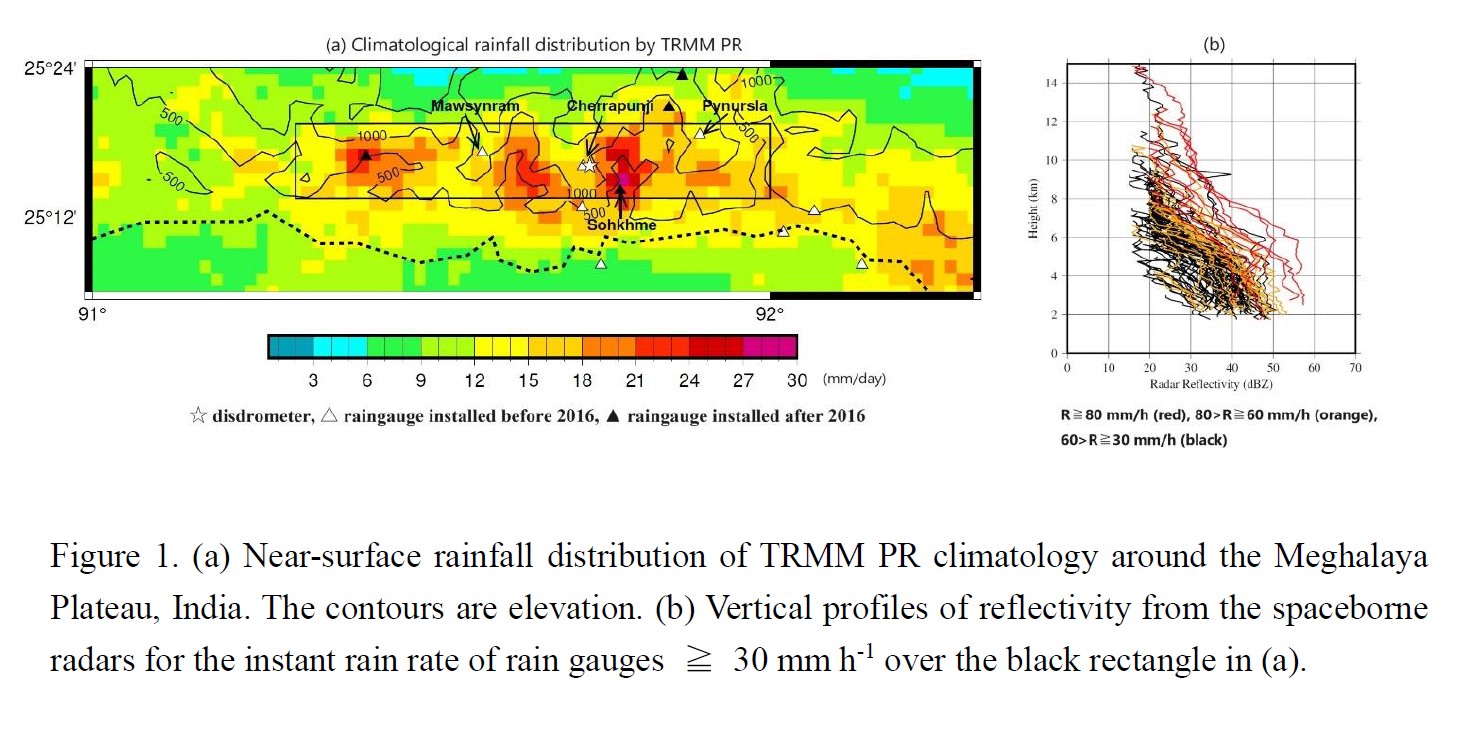
Plain Language Summary: The southern slope of the Meghalaya Plateau is known as the heaviest rainfall place. The climatological near-surface rainfall distribution retrieved from the spaceborne radar over the heavy rainfall area in the Meghalaya Plateau, India, showed heavier rainfall was detected in the valleys, whereas lighter rainfall on the plateau. This rainfall distribution is plausible, because intense surface rainfalls tended to occur from deeper convections, that were less affected by the ground clutter interferences of the spaceborne radar.
Highlights:
- Near-surface rain rate and raindrop size distribution of the spaceborne radars were validated using 43 rain gauges and 2 disdrometers in the northeastern Indian subcontinent.
- Intense surface rainfalls over the heavy rainfall area of the Meghalaya Plateau, India tended to occur from deeper convections, and such deeper convections more frequently occur in adjacent valleys nearby Cherrapunji and Mawsynram towns on the plateau.
- Though near-surface rain rate retrieved from the spaceborne radar is deteriorated by various factors, the intense surface rainfalls over the heavy rainfall area may be detectable.